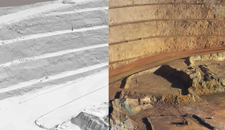
3D Reality Modelling
Dragonfly Capture can produce 3D models of existing conditions for infrastructure projects of all types, derived from drone photographs and/or point clouds. We create and use these highly detailed, 3D reality meshes to provide precise real-world context for design, construction, and operations decisions for use throughout the lifecycle of a project.
We use state of the art software (Bentley ContextCapture) and provide engineering-ready reality meshes that incorporate high-resolution photography. In addition, we can integrate your project survey mesh with GIS and engineering data to enable the intuitive search, navigation, visualization, and animation of that information within the visual context of the mesh to quickly and efficiently support the design process.
Examples of uses for a 3D Reality model
- Visual inspections
- General marketing,
- Training,
- Visualization or illustration enhancement,
- Design reviews (pre-construction engineering studies)
- Geological or geotechnical
- Etc…
To explore what a 3D Reality model consist, on a desktop computer, click the middle mouse button to rotate, the right button to pan, and the scroll wheel or the left button to zoom.
On a touch device, simply pinch and twist too rotate and pinch to zoom. Additional commands for measuring and display styles are available from the menu at the top right corner of the window.